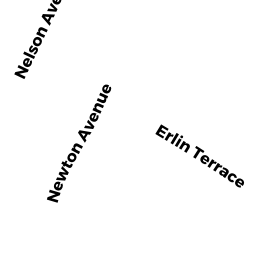
30 NEWTON TR
Owner Information
BAIN DONALD & CHRISTINA M
30 NEWTON TR
TEWKSBURY, MA 01876


Property Details
30 NEWTON TR is classified as a Single Family Residential (Raised - 2 story).
The primary structure on this property was built in 1988. There are 2,558ft2 of built area within this property. There is 1,632ft2 of residential/living space within this property.
30 NEWTON TR is valued at $416,000. The land is valued at $189,000 and the structures are valued at $226,600. There is an additional valuation of $400 on this property.
This property is in Zone R40. Confirm with local Zoning Board authorities to ensure there are no overlays or other easements on this property.
The most recent deed for 30 NEWTON TR is recorded at the local registrar in Book 32418, Page 3401. 30 NEWTON TR was last sold on Friday, March 15, 1996 for $1.
Assessment data from fiscal year 2021.
Flood Data
This property is partially within the AE Zone (within floodplain). Approximately 0.19 acres (53.99%) of the property is within this zone.
This information is sourced from the FEMA National Flood Hazard Layer. See our full disclamer.
Broadband Internet Providers
| Provider | Type | Bandwidth (mbps) | |
|---|---|---|---|
| Crown Castle Fiber | Fiber | 0 | 0 |
| Verizon New England Inc. | DSL | 10 | 1 |
| Verizon New England Inc. | Fiber | 940 | 880 |
| Comcast | Cable | 1000 | 35 |
| GCI Communication Corp. | Satellite | 0 | 0 |
| HughesNet | Satellite | 25 | 3 |
| VSAT Systems, LLC. | Satellite | 2 | 1 |
| Viasat Inc | Satellite | 100 | 3 |
Broadband service provider data from December 2020.
Adjacent Properties
- 935 MAIN ST
(formerly Municipalities/Districts. Removed June 2009.) owned by TOWN OF TEWKSBURY - 20 NEWTON TR
Single Family Residential owned by MAYNARD ADAM ROBERT & ALYSSA Z - 885 MAIN ST
Other, Open Space owned by VILLAGE LANDING ASSOC - 885 MAIN ST
Professional Condo owned by AJKD LLC - 885 MAIN ST
Professional Condo owned by KWON YOUNG AHN TR - 885 MAIN ST
Professional Condo owned by COREVITA LLC - 885 MAIN ST
Professional Condo owned by TOTO JOSEPH CARL JR - 885 MAIN ST
Professional Condo owned by SERGI R E & BENEVENTO H A TR - 885 MAIN ST
Professional Condo owned by HOGAN REALTY MANAGEMENT LLC - 885 MAIN ST
Professional Condo owned by HOGAN REALTY MANAGEMENT LLC - 885 MAIN ST
Professional Condo owned by CAMBRIDGEPORT LLC - 885 MAIN ST
REST/CLUBS MDL-06 owned by A & G REALTY TRUST - 885 MAIN ST
Professional Condo owned by MCKENZIE JOHN S TR - 885 MAIN ST
Professional Condo owned by AJKD LLC - 40 NEWTON TR
Single Family Residential owned by KIMTIS ROBERT J JR - 10 ERLIN TR
Nursing Homes - includes property designed for minimal care with or without medical facilities owned by ERLIN TERRACE LIMITED PART